Experience Pictured Rocks National Lakeshore with This 2-Day Itinerary
Taking a road trip around Michigan’s Great Lakes has been on my USA bucket list for years! When I finally started planning our 2-week Michigan road trip, there were a few places I had often seen in photos that had to be on our itinerary. This included two of the three national lakeshores that I had heard so much about—Sleeping Bear Dunes and Pictured Rocks National Lakeshore. Lighthouses, waterfalls, and a memorable kayaking adventure rounded out our 2-day itinerary exploring Pictured Rocks National Lakeshore. Keep reading for all the details.
This post contains affiliate links. If you purchase something, familyTravelsUSA may receive a small commission. As always, opinions are my own.
With just a quarter of the visitors in 2025 compared to Yellowstone National Park, I knew Pictured Rocks would be a different kind of national park experience than we were used to. Located in Michigan’s Upper Peninsula (UP), the park is known for its colorful cliffs on the shores of Lake Superior. Even more appealing to us was the ability to see the park from both land and water.
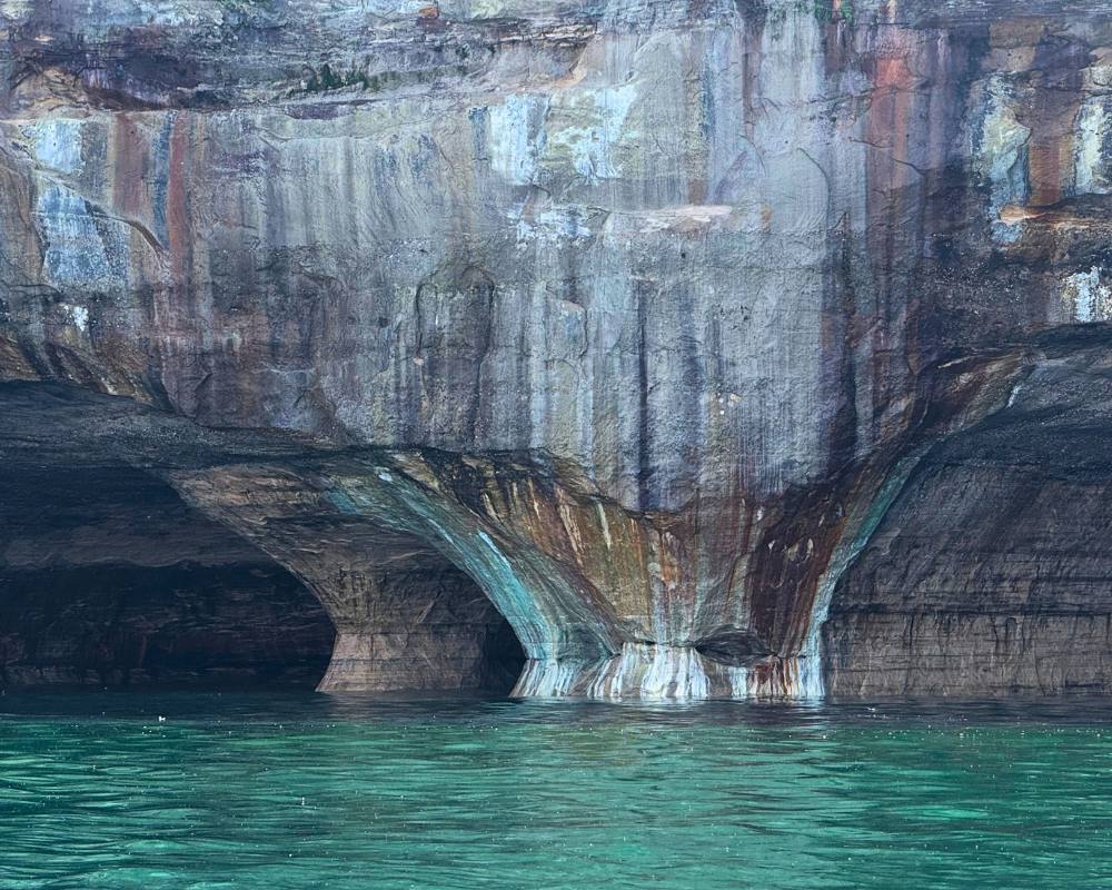
The National Park Service writes “Stunning colors occur when groundwater oozes out of cracks and trickles down the rock face,” so we knew kayaking for an up-close view of the colorful, sandstone cliffs was a must-do. Don’t worry, if kayaking is not your thing, you can still take a regular boat tour to enjoy the view from the water.
The park has both an east and west entrance, with the smaller Grand Marais in the east, and the larger Munising in the west where most visitors stay. Munising is convenient for access to boat tours, as well as hotels and restaurants. It is just under an hour to nearby Marquette, home to a small regional airport.
We happened to be traveling in from the east side of the park, after a wonderful first visit to Mackinac Island. This made it convenient to explore the park on land from east to west the first day, overnight in Munising, then depart on our nearby boat tour with Pictured Rocks Kayaking the next morning. Here’s what we did in two days exploring Pictured Rocks National Lakeshore.
Table of Contents
Day 1 Itinerary at Pictured Rocks
Checked in at the Grand Sable Visitor Center with our annual pass, picked up park maps, and chatted with the ranger to learn more about the park. There’s not much else at this location, other than restrooms and a water-filling station.
Using the National Park app, we mapped out our drive from East to West. The self-guided scenic drive along CR-H58 (around 50 miles) hit all the popular spots, with a suggested time of 3-6 hours including stops. For each location, there is a brief description on the app, so we learned about lumberjacks, logging, and life at the Au Sable Light Station along the way. Always download the specific park for offline use before arrival to ensure access to activities and maps.
First up was Sable Falls, not far from the Grand Sable Visitor Center. One hundred sixty-eight steps took us down to impressive Sable Falls, the tallest in the park. You can continue on the trail to a beach area, returning the same way you came.
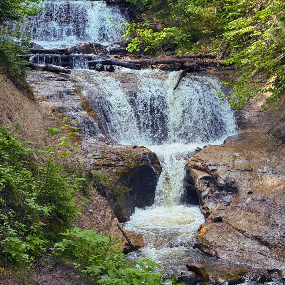
Sable Falls was our first encounter with the infamous UP mosquitoes. Thankfully(!) we had mosquito nets that fit over our hats, face, and neck, and the weather was cool enough to be comfortable in long pants and jackets. These, and bug spray, are essential items for summer in Michigan’s UP. When people tell you the mosquitoes and black flies are bad in the UP, believe them!
Continuing our drive, the overlook at Grand Sable Lake provided lakeside views and a picnic area. We were more excited about the next stop at Log Slide. It was pretty cool to learn how back in the day the logs were transported from top of the sand dune down a long wooden chute to Lake Superior and ultimately to a mill in Grand Marais.
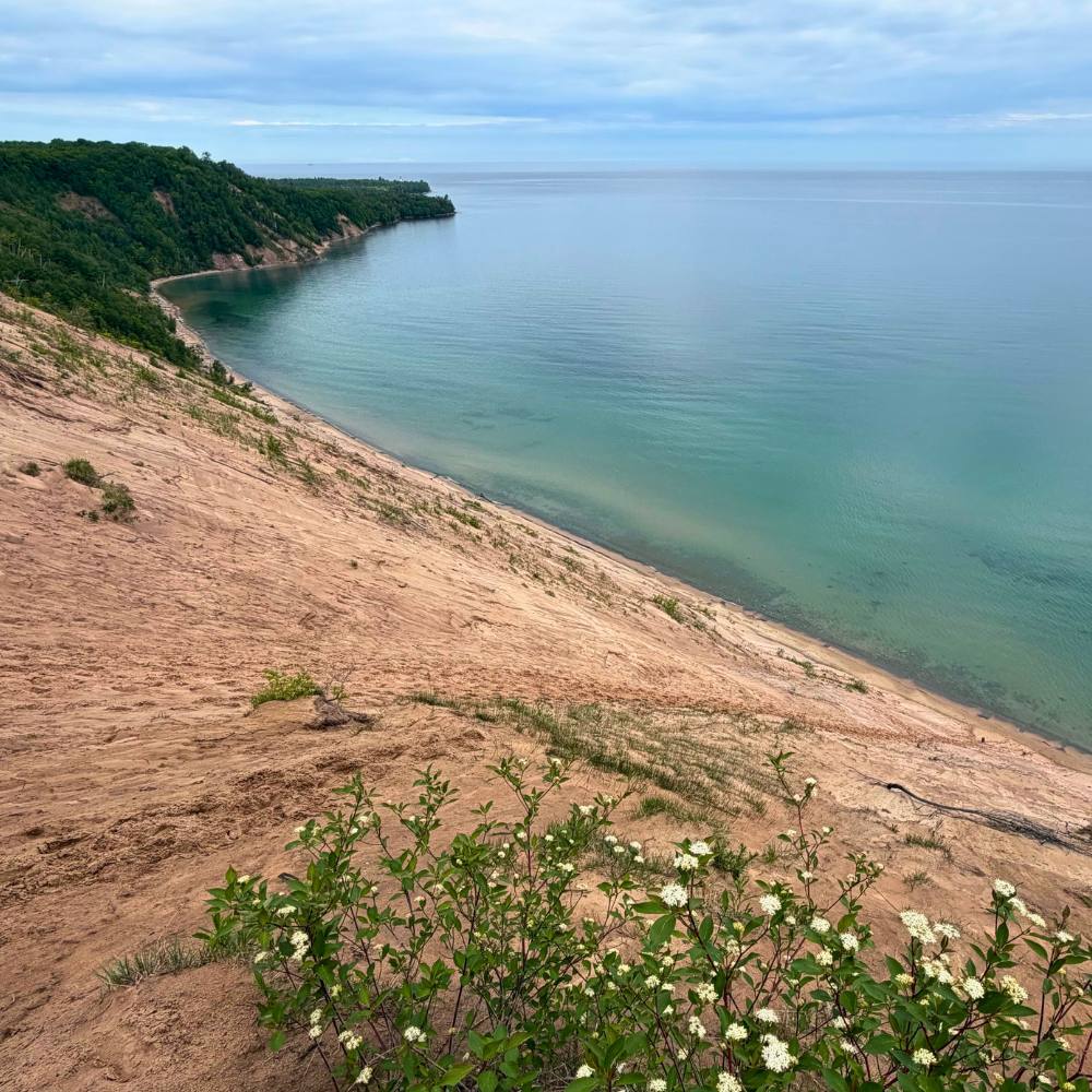
The views at Log Slide are expansive, and visitors are cautioned about making the trek to the water down the steep dune (over 300 feet). It’s easy to get excited about running down, and we witnessed folks struggling on the way back up both here and at Sleeping Bear Dunes! Shoes, sunscreen, and water are essential!
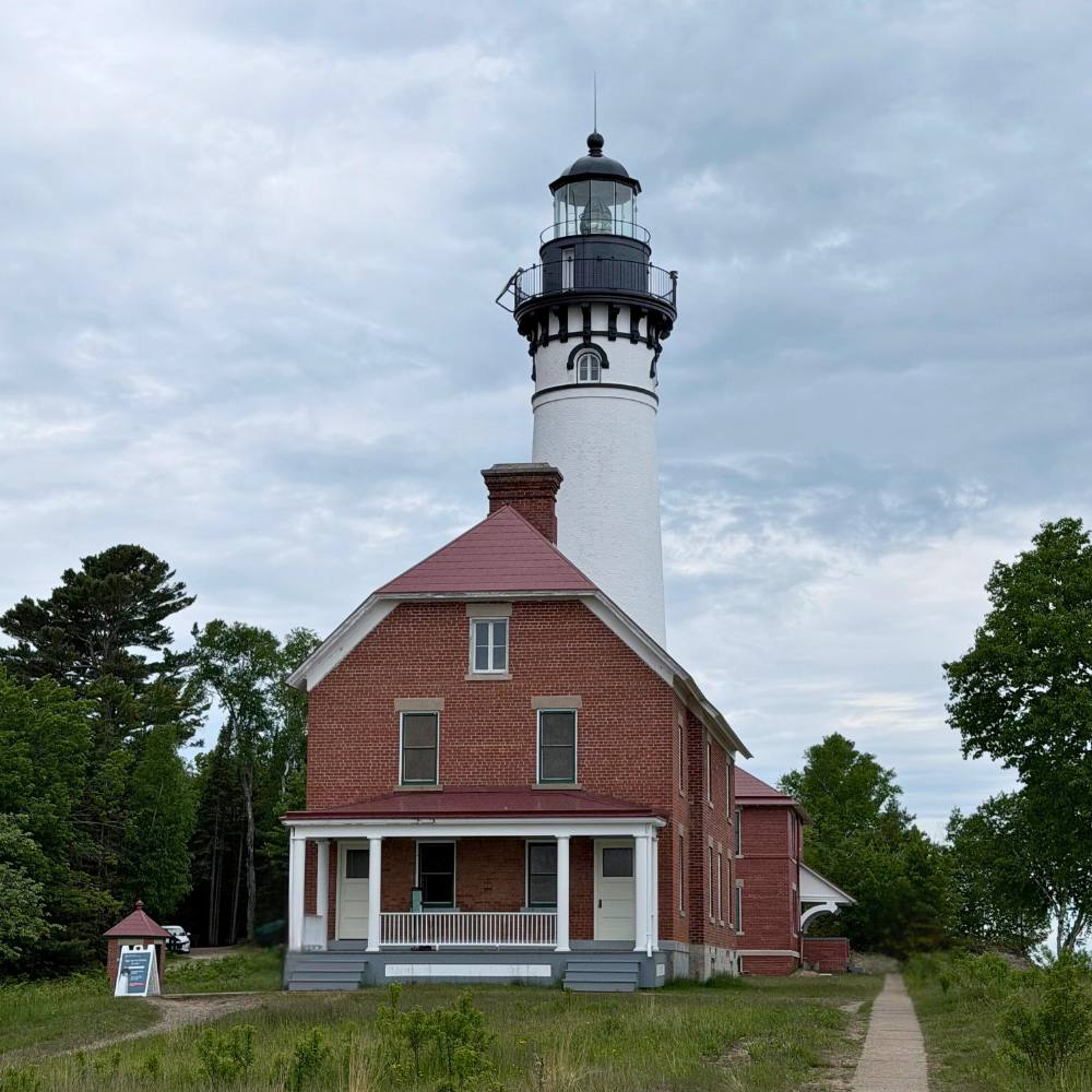
Our next hike took us to the Au Sable Light Station with the intention of climbing to the top with a ranger-lead tour. The trailhead started near the Hurricane River campground, 3 miles round-trip on an access road. Swarms of mosquitoes followed along, so the bug nets really saved us. Look for signs and pop out onto the beach along the way—if the tide is low, you may see shipwreck relics! Sadly, our timing was off, so we didn’t get the chance to do the guided lighthouse climb, which happens throughout the day in the summer except around lunchtime.
Many of the longer hikes in the park are in the Chapel Basin and Mosquito area, which we didn’t explore. With recent rain, we heard the trails were muddy and buggy, so we decided to skip the hikes to Mosquito Falls, Chapel Falls, as well as Chapel Rock. Knowing we were going to see some of these areas from the water helped with our decision.
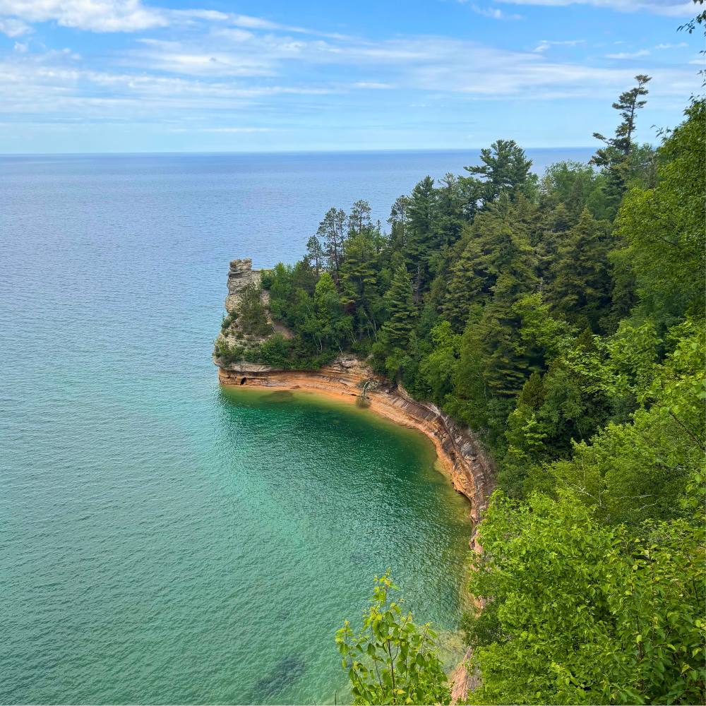
The highlight of the drive for both hikers and non-hikers alike is the Miners Castle stop. The views from the main overlook are incredible. You will see a portion of the cliffs and rock formations. Check out some of the lower viewing platforms if you can. There is also access to the trail to Miners Beach at this location.
Not far from Miners Castle is the access road to Miners Falls. It’s a short (1.2 miles round trip) walk to view the falls. Taking the 64 steps at the end will give you the best view of this impressive waterfall from the overlook.
The road continues with an optional stop at Sand Point Beach before reaching Munising, home to another small visitor center. Access to Munising Falls is closed (as of June 2026) due to a washout earlier in the year.
The end of the route was convenient to our overnight stay at the Greenland Motel, just outside of town. This recently renovated boutique motel was perfect for our 2-night stay. Don’t miss a stop in Munising to meet the friendly folks that run The Cooking Carberry’s Woodfired Pizza (cash only). The Savory Blueberry Pizza was amazing! They are adjacent to East Channel Brewing Company, so you can wash down the pizza with a blueberry lager! Breakfast at Earl E. Byrds was also delicious, fueling us up for a big day on the water!
Day 2 Itinerary at Pictured Rocks
We booked the Ultimate Kayak Tour with Pictured Rocks Kayaking about a month prior to our visit. I was obsessed with checking the weather forecast for about 10 days prior, fingers crossed that we would have a smooth day on Lake Superior. As it turned out, we couldn’t have asked for better weather!
The trip starts with a safety briefing outside the store, then a short boat ride. Tandem kayaks were seamlessly launched in groups from the back of their custom-designed boat. The stability of entering and exiting the kayak from the launch platform was a definite plus!
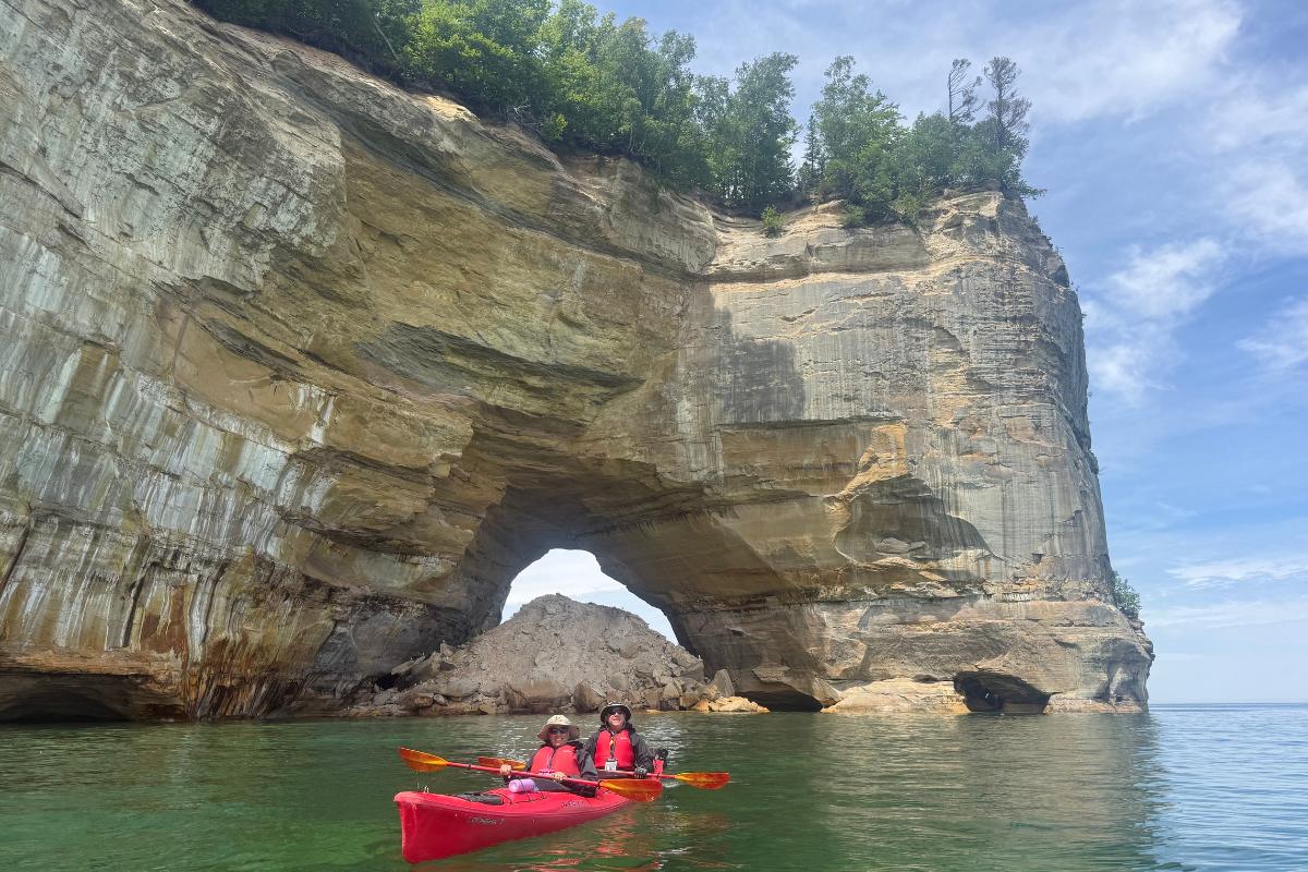
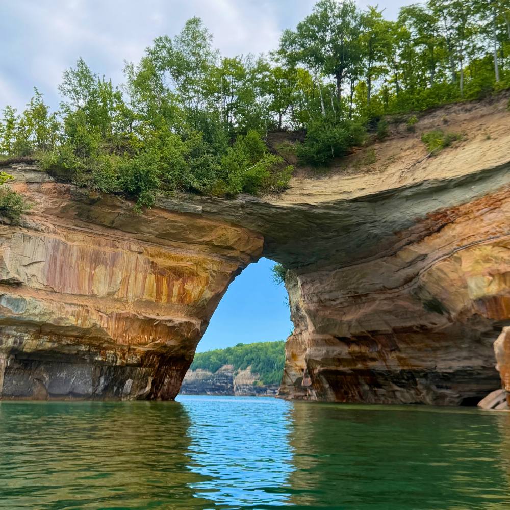
On the Ultimate Kayak Tour, our guide led our group of 6 kayaks past some of the most stunning landscapes at Pictured Rocks including Lovers Leap, Rainbow Cave, and Chapel Rock. Lake Superior’s water in this area is incredibly green and super clear, and we often could see giant boulders just beneath the surface.
Depending on the angle of the sunlight or cloud cover, the colors of the rocks and water varied along the way. It is a bucket list experience for sure. The views were so mesmerizing that you barely noticed the 5-mile paddle.
The process of getting the guests and kayaks back on the boat was also a well-oiled machine. I appreciated the fact that our guide had taken a ton of pictures on his phone and shared them with the group for free. The whole experience ranked among our top kayak tours, on par with our adventure in Seward, Alaska.
We highly recommend Pictured Rocks Kayaking for a memorable trip. They offer other tours as well, including a shorter ride to Miners Castle. If you just want a boat cruise, Pictured Rocks Cruises is the National Park Service concessionaire. Keep in mind that the tours and conditions on Lake Superior change quickly, so having multi-day scheduling flexibility is helpful.
General Things to Know Before Visiting Pictured Rocks National Lakeshore
*Always check the park website for the latest alerts before you arrive. Roads and trails are sometimes closed due to weather-related or road issues.
*Get on the water! Taking a boat or kayak tour is a must to truly appreciate the beauty of Pictured Rocks National lakeshore so plan ahead. Most tours depart from Munising and are weather-dependent. Sometimes tours get cancelled depending on conditions on Lake Superior, so having an extra day is helpful.
*A 2-lane road runs through the park between Grand Sable Visitor Center in the east and Munising in the west.
*The North Country Trail runs the length of the park. We intersected the trail throughout the day on short hikes.
*The National Park app breaks down the hikes into shorter and longer routes, which is great for planning purposes. We love having access to the details by downloading the park for offline use.
*The Chapel Basin and Mosquito area of the park is home to some of the longer hikes, with a separate trail map. We often heard from folks during our June visit that the trails were muddy and super buggy.
*Always be prepared with bug spray, water, sunscreen, and a mosquito net.